Rayley
The late mediaeval iron mine at Rayley or Raly was probably on Railey Fell. This name refers to the steeply rising ground above Ramshaw, 1km to the north of Evenwood and possibly to the whole area of higher ground between the Gaunless and the Linburn Beck.
Coal is found at shallow depths all over this area. The iron ore is found as nodules of iron carbonate in a layer perhaps 10 feet below the coal measures. Tylecote found an example revealed by open-cast mining at Rowntree where a bell pit had dug through (and ignored) the four foot thick coal seam to reach the iron ore below.
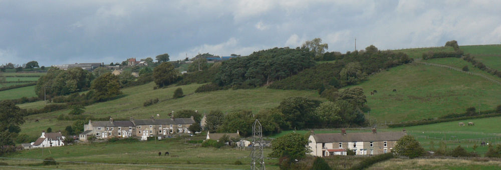
Railey Fell from Evenwood
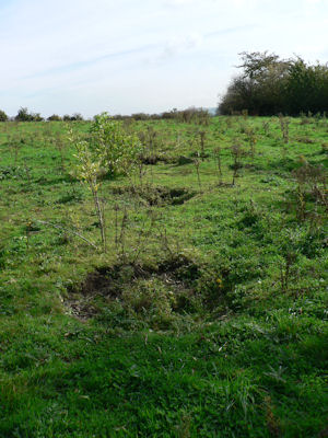 Intriguingly
I found four small depressions in a line, each about 1 metre in
diameter and spaced at 3 metres apart, alongside the foot path
on the skyline of the photgraph above. However they seem far too
well defined to be very old.
Intriguingly
I found four small depressions in a line, each about 1 metre in
diameter and spaced at 3 metres apart, alongside the foot path
on the skyline of the photgraph above. However they seem far too
well defined to be very old.
The Durham Mining Museum locates the much later Railey Fell Colliery at NZ 16100 28800. This is just south of Sloshes Farm in Low Etherley.
The Story of the Gaunless Valley; Niall Hammond:
p16.
Workings in the area date back to at least 1354 when at Softley
the monks of Finchale Abbey to the
p22. Many drifts and shafts were also being worked on Railey Fell, an area to the north of modern-day Ramshaw, covering land from the River Gaunless to Rowntree in the north-west, and over towards Phoenix Row in the north-east, and down the A68 road in the east to Spring Gardens. Leases dating from 1525, 1569 and 1784 still survive. In 1781 British Coal records indicate that unnamed seams were abandoned at Etherley, West Tees and Railey Fell collieries.
"In 1368, [Bishop Hatfield] granted for a term of years a
blomestage, bloomery, or iron furnace, in Gordon and Evenwood
Park, at the rent of 16s. a week, the dry wood for that purpose
to be delivered by Allan, the Bishop's senescal, John de
Kingeston, constable of Durham, or some person especially
deputed."
Indenture dated 18th July 1368 The History and Antiquities of
the County Palatine of Durham, Volume 3 p338 by William
Hutchinson.
""That within the manor or barony lie the townships of Killerby, Evenwood and West Auckland. That there is belonging to the aforesaid barony a great common or waste, called Raley-fell, on which cattle are put without stint; but there is no wood on the same, nor any in the barony." (1646) (Source as above)
"... relating to a lease of the coal mines of Raley-fell,
alias Carter Thorne, which had been granted by the late
Bishop of Durham to Lord Eure and others. Records exist of a law
suit in 1667 relating to ..."
Annals of coal mining and the coal trade: R.L. Galloway
1898
Toft Hill is a long straggling village in that portion of the
township [of Evenwood and Barony] known as Barony
History, topography, and directory of the county palatine of
Durham:Whellan, William, & Co
Whittaker and co., 1856 - History - 1068 pages
Toft Hill is a hilltop village in County Durham, in England straggling along the A68, a few miles to the west of Bishop Auckland and adjoining the village of High Etherley. An ancient site of defensive settlement and used by the Romans, the name of Toft Hill is possibly of Norse or Angle derivation and actually means "Hill Hill". The village is underlaid by coal measures and saw expansion in the 19th century mining boom under the coal-owning Stobart family. The various drifts of their Carterthorne Colliery formed large extended galleries beneath the village. In recent years much of the village's archaeology has been swept away by open cast mining.
Henry Chaytor, of Witton Castle, operated this pit, in 1870, Hodgeson and Simpson taking over the interests in 1885. Carterthorne Colliery Owners, took over in 1886, later in 1891 Chaytor wanted to restart the Colliery which was then leased on a lease from, The Earl of Strathmore, this being a yearly lease, for a total of 14 years, this was never executed. The case was heard in the High Court Chancery Dept; and the receivers, Walton & Dowdeswell, had to run the pit in 1887, until putting it up for sale in 1895. For some years the pit was worked then finally closed in 1925.